
The latest on the spring storm from Environment Canada
The latest warning from Environment Canada says we're not through it yet.
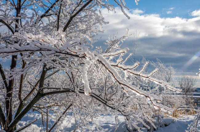
The forecasting agency warns of a prolonged period of freezing rain, with ice accretion reaching 10 to 20 mm, and possibly exceeding 25 mm in some areas.
Here is the latest forecast; Freezing rain changing to ice pellets or snow and ending late this morning then mainly cloudy. Wind northeast 20 km/h gusting to 40. High minus 1. Wind chill near minus 8.
Tonight: Cloudy. Freezing rain beginning this evening. Wind northeast 20 km/h becoming light near midnight. Low minus 2. Wind chill near minus 8.
Tomorrow: Freezing rain changing to rain near noon. Wind up to 15 km/h. High plus 4. Wind chill minus 7 in the morning.
Sunday night: Rain or freezing rain. Low zero.
Roads and sidewalks are icy and slippery, making travel hazardous.
The freezing rain may ease this afternoon, briefly transitioning to snow or ice pellets before intensifying again tonight. Conditions are expected to improve Sunday as temperatures rise above zero.
Again, residents are being asked to be ready for falling tree branches and power outages due to ice build-up. Public Safety Canada advises people to make an emergency plan and gather supplies, including water, food, medicine, and a flashlight.
Non-essential travel should be postponed until conditions improve. More information on emergency preparedness is available at getprepared.gc.ca.